The ASOC ,
The CPS ,
The Sea Trials ,
The Walk Around
The purpose of AQUASTRADA Computer Positioning System (CPS) is to aid the vehicle operator in controlling the course/route of the vehicle by providing the vehicle operator with a computer generated display of an insular map with an icon indicating the vehicle's current location on the map.
The CPS is comprised of a series of tandem application specific processors. The redundancy of the various processors is intended to guarantee the dependability of the CPS.
The automatic positioning system computer is the master computer. The automatic engine control and automatic shift computers are slave computers.
The function of the automatic engine control computer is to cause the engine to run in the most efficient manner per its current operating conditions. This computer samples such things as throttle position, engine revolutions per minute and ambient air temperature in order to compute such things as fuel and ignition timing map recurving. There is no user serviceable part in this computer.
The function of the automatic shift computer is to perform the functions necessary for AQUASTRADA to make land-to-water and water-to-land state transitions. This computer samples various external sensors during the transition from land to marine and back again. There is no user serviceable part in this computer.
The function of the automatic jet nozzle trim is to guarantee the Aquastrada maintains horizontal operation in the water while the vehicle is under power. This computer samples such things as a level indicator in order to calculate the proper jet nozzle trim. There is no user serviceable part in this computer
All remaining CPS functions are the responsibility of the positioning system computer. Integral with the CPS is a multifunctional CD drive unit. The primary function of this unit is to supply the vehicle specific information needed by the central processing unit in order to enable the CPS. Additionally, this unit also supports music and entertainment.
The CPS display unit is a color flat panel Very High Resolution video display unit (VDU). The VDU not only provides video output for the vehicle operator, but also accepts input from the vehicle operator via an integrated touch sensitive screen. Optionally, an additional extra large Very High Resolution VDU with a touch sensitive screen is available as a conference screen. Also available for the conference screen is an Ultra High Resolution VDU. Vehicle operator input is also possible on the CPS via a touch sensitive pad located in the center of the vehicle steering wheel.
The vehicle direction and location displayed by the CPS is determined by inputs from the G.P.S. land / satellite communications unit and the magnetic compass unit. The radar unit and video input unit support additional CPS displays.
Software features of the CPS include the following:
- Scalable map display.
- Radar display.
- Rear view display.
- Trip monitor display.
- Vehicle status display.
- Automatic error detection and display.
- Touch sensitive operator input devices.
AQUASTRADA and CPS security is reinforced by the issuance of a unique CD access disk with each vehicle. Failure of the vehicle operator to present a valid access disk to the CPS results in a shutdown of both AQUASTRADA and the CPS.
Note that the map database files are generated by AQUASTRADA International Corporation from client supplied data. Also note that the client supplied data must conform to the format specified by AQUASTRADA International Corporation.
Operator Interface:
The CPS does not have a keyboard, however, the interactive operator interface is supported by representing system functions with intuitive icons, refer to
figure 1.
Thus both an inexperienced, or experienced user may easily use the CPS.
Operator input is accommodated via touch sensitive devices; display items are selected and executed by touch. The display screen is touch sensitive, and, there is a touch sensitive pad incorporated into the steering wheel. The touch sensitive pad in the steering wheel is similar in shape to the display screen and provides the vehicle operator with the ability to operate the CPS while keeping both hands on the steering wheel.
There are several functions always displayed across the top of the VDU. The primary CPS displays, namely, the map, radar and rear view displays, are summoned by selecting their corresponding icon. These displays are described below.
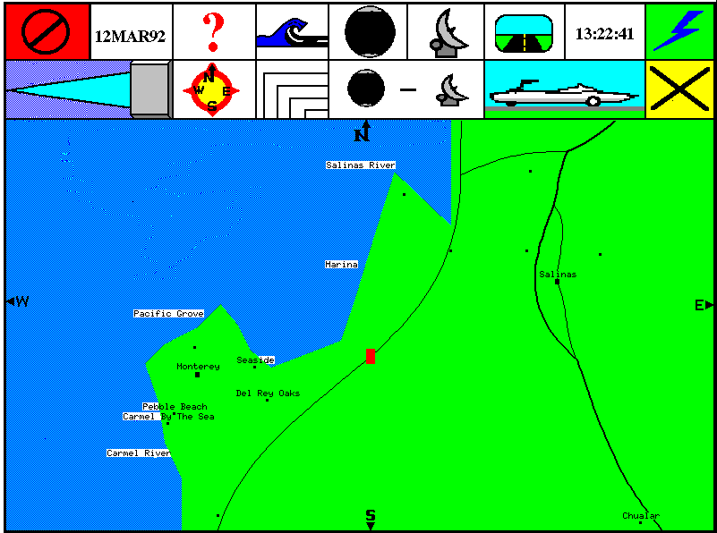
The Display Map
The map display is the default display of the CPS. The map display is capable of supporting a map covering 6,437,700 square kilometers, 3218 kilometers ease/west by 3218 kilometers north/south. This area is approximately twenty-five degrees longitude by twenty-five degrees latitude at the equator. The CPS is capable of "zooming in" at 1% increments. The map displayed with the least degree of resolution is approximately 3218 kilometers east/west by 2006 kilometers north/south; the map displayed with the most degree of resolution is approximately 12.8 kilometers east/west by 8 kilometers north/south.
An icon representing the vehicle also appears on the map display by default, and, by default, the map is displayed such that the vehicle icon is centered in the display. The user may reposition the vehicle icon anywhere on the display. Repositioning this icon causes the map to be re-displayed per the repositioned icon.
The map display also includes the points of the compass, refer to
figure 2: scalable map display. Furthermore, when the compass function for this display is enabled, the map displayed is oriented to the bearing of the vehicle. Also, note that when the map is rotated per changes in the bearing of the vehicle, the map information, for example, city names, road names, river names, also move. And, this information is always displayed horizontally on the screen.
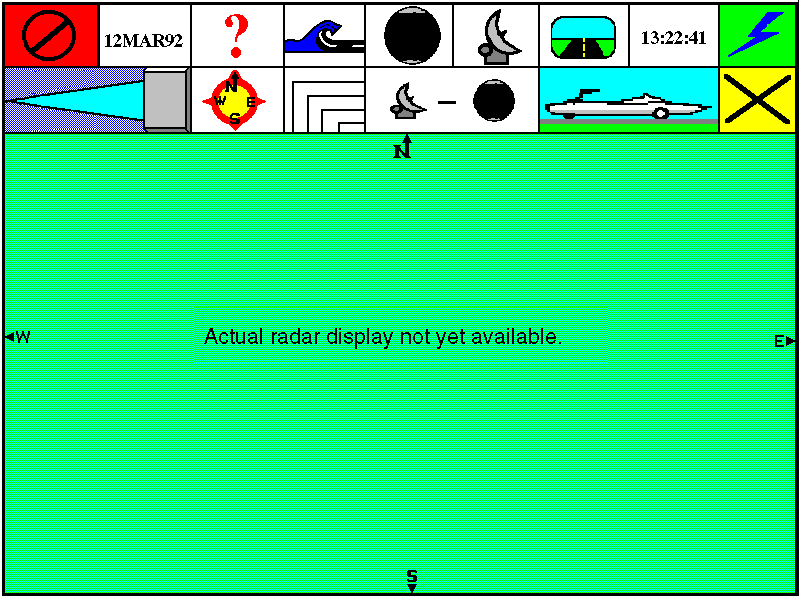
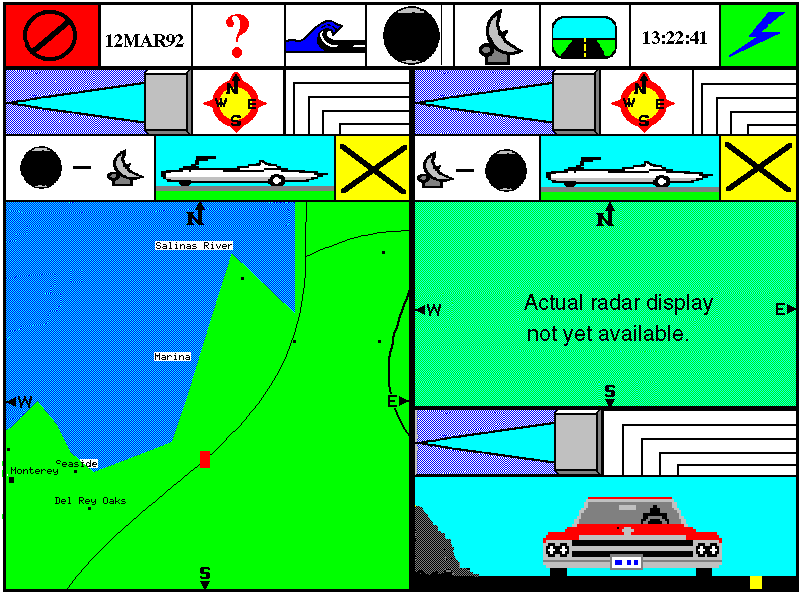
The Radar Display
The radar display is provided primarily to support negotiation of waterways. This display is particularly useful in low visibility situations. The radar display is capable of displaying images within a twenty-five mile radius.
An icon representing the vehicle also appears on the radar display, and, the icon appears in the center of the display.
The radar display also includes the points of the compass, refer to
figure 3: Radar display.. Furthermore, when the compass function for this display is enabled, the image displayed is oriented to the bearing of the vehicle.
Additionally, the operator may optionally overlay the radar display onto the map display, refer to
figure 4: Rear view display.. The radar display matches the map display data when the map display is at the highest degree of resolution.
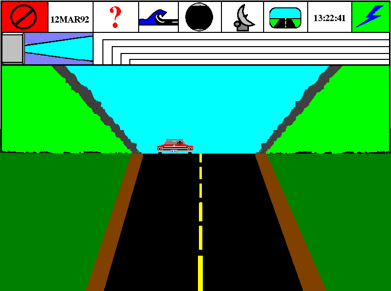
The Rearview Mirror
The rear view display is provided primarily to support negotiation on water, particularly for docking at the rear of the vehicle, refer to
figure 5: Rear view display..
Utility Displays
There are several functions always displayed across the top of the VDU. The help function's icon is a question mark ("?"). Selection of this function causes the CPS operator's utility menu to be displayed. Functions contained in the utility menu include the following:
- CPS Operator's Manual
- CPS Configuration
- CPS Status
- CPS Displays
- CPS Diagnostics
- Trip Monitor Display
- Vehicle Status Display
Note that a copy of the operator's manual is kept on CD ROM and is available via the help function.
The CPS configuration function allows the operator to select the language in which text is to be displayed. This function is also used to modify the CPS current time and date. Also, this function is used to track installed devices such as a conference screen or slave computers.
The CPS status function displays the operational status of the various CPS devices such as the Global Positioning System, the compass, etc.
The CPS Displays function allows the operator to save and restore any displayed video image. This function also supports selection of the type of icon to be used to represent the vehicle in the appropriate displays. Also, this function is used to select the desired defaults for the various displays such as compass function "ON" or "OFF" or degree of "zoom".
The CPS Diagnostics function allows the operator to select individual tests from the "Power On Self Test" such as the RAM test. This function also supports additional diagnostics such as a touch sensitive screen check.
Trip Monitor Display
The trip monitor function displays statistics for a plotted course which include the following:
- Distance to be traveled on land.
- Estimated time for travel on land.
- Distance to be traveled on water.
- Estimated time for travel on water
- Total estimated time for trip.
- Distance left to be traveled on land.
- Estimated time left for travel on land.
- Distance left to be traveled on water.
- Estimated time left for travel on water.
- Total estimated time left for trip.
- Estimated arrival time.
The distances may be displayed in miles and/or kilometers and/or nautical miles.
Additionally, the trip monitor function displays a dynamic fuel consumption analysis which includes the following:
- Fuel consumption on land from start of trip.
- Fuel consumption on water from start of trip.
- Current fuel consumption for current surface (land or water).
- Estimated fuel consumption for remaining travel on land.
- Estimated fuel consumption for remaining travel on water.
- Total estimated fuel consumption for remainder of trip.
- Amount of fuel currently on board.
This information, as above, may also be displayed in any combination of English, metric or nautical measurements.
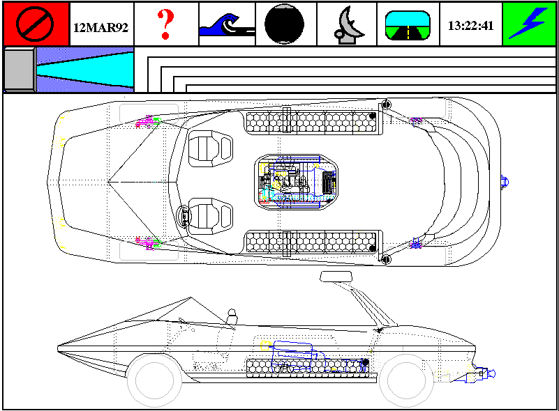
Vehicle Status Display
The vehicle status display is accessed via the utility functions, refer to
figure 6: Vehicle Status Display..
Note, however, that via the CPS automatic error detection, the vehicle status display is produced zoomed in to the highest priority error condition. Subsystems monitored by the CPS include, but are not limited to the engine, drive train, brakes, pneumatics, hydraulics and fluid levels. The CPS has an artificial intelligence repair sequencer with a maintenance tracking log and a parts ordering system.
Display Windowing
Finally, the user also has the capability of manipulating the size and shape of each of the map, radar and rear view displays. Thus the user may view more than one display simultaneously. The screen change function allows the user to move any horizontal or vertical boundary of a display. The screen change function also allows the user to position a display on the screen, refer to
figure 7: Sample map, radar and rear view display arrangement..
The ASOC ,
The CPS ,
The Sea Trials ,
The Walk Around
Page provided by
 's
Monterey Office
(-3).
's
Monterey Office
(-3).
This page is maintained by RUSSELL HOLDER and
does not represent any views or policies of and is not affiliated
in any way with my employer.
Previous update: 30AUG96 2345HRS
Last update: 07SEP96 2145HRS
Russell@dra.com


